
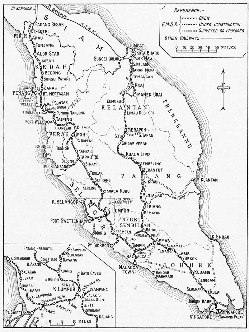
The origins of the Malaysian peninsular as a series of independent states led to a piecemeal development of the metre gauge railways system with the first two sections opening in 1890. It was to be 1909 before Singapore was linked to Penang and 1920 when the line reached the Siamese border; whilst the east coast line from Gemas to Kota Bharu was not completed until 1932.
To view any full size image and caption details please click the maroon button below each thumbnail