
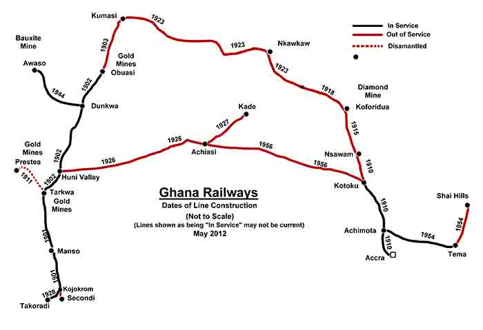
As can be seen from the above map, there has been a decline in railway operations over the last few decades with no operations over large parts of the network, although as elsewhere in West Africa there are plans to renovate these. A contract was apparently signed in 2010 to construct a line between Kumasi and the border with Burkina Faso.
The first section of line to open was the 39 miles between Sekondi and Tarkwa, a railhead for the Ashanti goldfields; with remaining sections to Kumasi of what became known as the Eastern Railway opening over the next couple of years, making a total length of some 164 miles. The Western Railway north from Accra was slower in development, the first 26 miles to Nsawam opening in 1910 but it was another 13 years until it too reached Kumasi.
To view any full size image and caption details please click the maroon button below each thumbnail