
There was no physical connection between the railway systems in these countries.
There has been only limited activity on the railways of Togo since the millenium,
following the cessation of passenger services on the state railway in 1999.
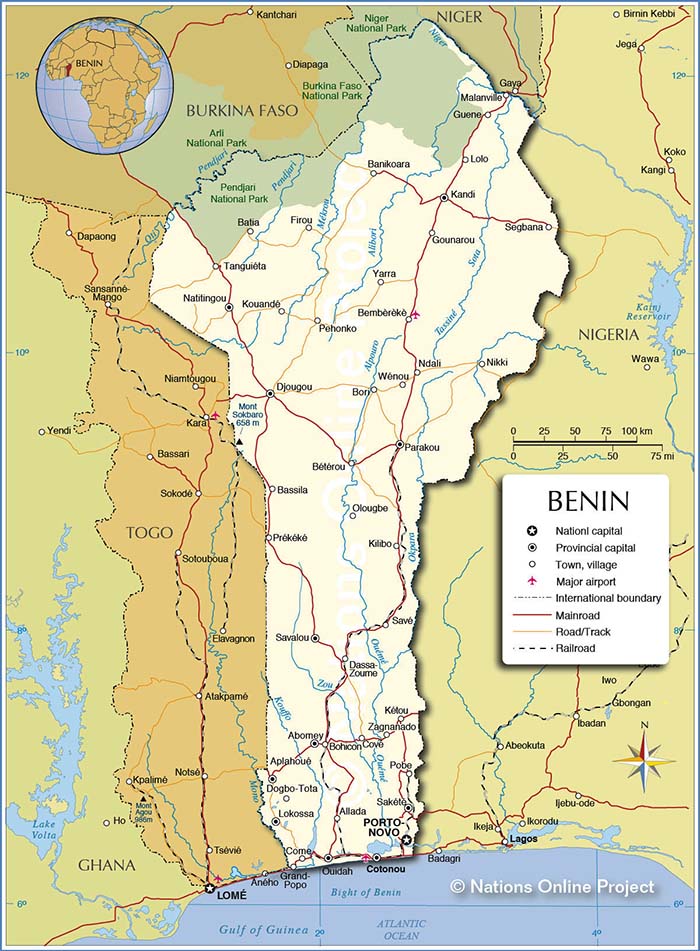
Some lines in
Benin have been closed but the Northern line to Parakou operated by the Organisation Commune
Bénin-Niger des Chemins de fer remains open after a fashion in that passenger services ceased
around 2007 and there are only now sporadic freight trains. The railways were built during the
French colonial era when the country was known as Dahomey. After gaining independence in 1958 it
was renamed Bein in 1975. Work did commence some years ago on the long planned extension to
Niamey in Niger but later stalled. There are long term further plans to create a link from
there to the CF Abidjan-Niger in Burkina Faso and upgrade both lines to modern standards.
Information & pictures of these and other African railways can be obtained at this German
site Fahrplancenter
that includes English captions and in a report by Thomas Kautzor on Rob Dickensons
International Steam site.
To view any full size image and caption details please click the maroon button below each thumbnail