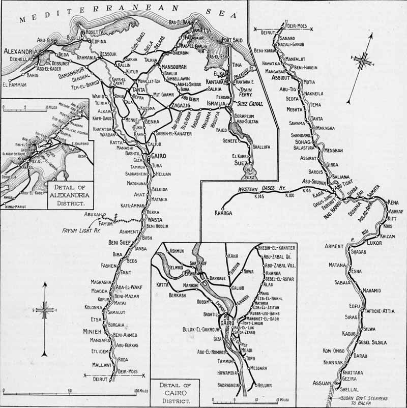
The State Railways at this time operated some 2250 route miles of standard gauge
track and a further 125 miles of 2ft 6in gauge in the form of the Western Oases Railway
to Kharga. The line from Alexandria to Cairo was the first railway on the African
continent, and the first section was opened to Kafr-el-Zayat in 1854 and the section
on to Cairo was opened in 1856. This involved the construction of two bridges over the
Nile, one at Kafr-el-Zayat and one at Benha. Cairo was then linked to Suez by a line
opened in 1858 so providing the first modern transport link between the Mediterranean
and the Red Sea, 11 years ahead of the Suez Canal. The line south from Cairo down the
Nile valley was opened in stages to Assiut between 1867 and 1874 and on from Assiut to
Qena between 1892 and 1897. In 1895 a concession was granted to the Societe du Chemin
de Fer de Kena a Assouan for a metre gauge line linking the two but this changed to a
standard guage line on down to Luxor and a 3ft 6in gauge one on to Aswan, both opening
in 1898. At Aswan it connected to another 9 mile long line to Shellal built earlier to
bypass the first cataract on the Nile when shipping military supplies to the Sudan.
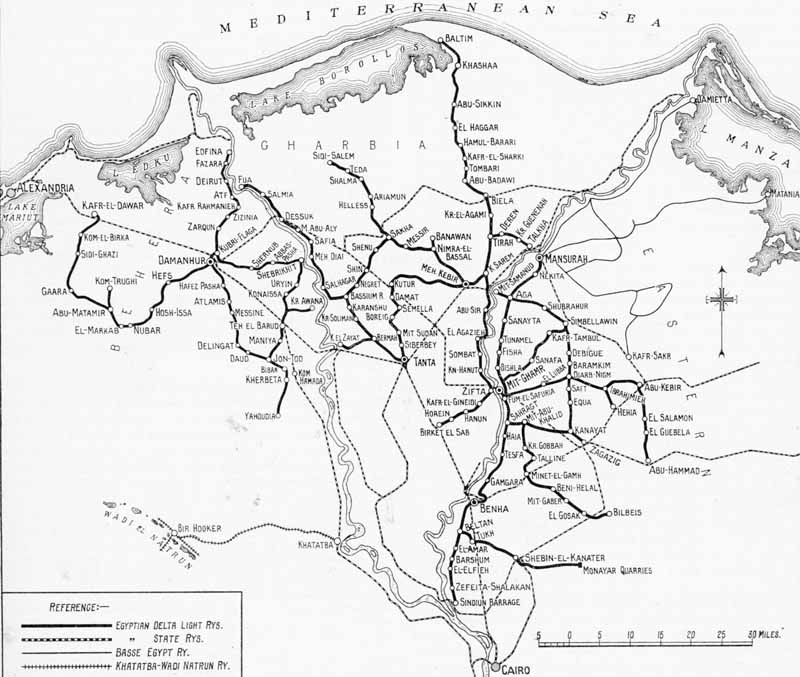
In 1900 London based Egytian Delta Light Railways Ltd. took over two earlier concessions
and greatly expanded the network of 750mm gauge lines in the triangle generally east of
a line between Cairo and Alexandria. Control passed to the Egyptian Goverment in November
1945 and services were suspended in 1952 due to financial problems.
All the pictures here were taken in 1920s and 1930s and come from publications in Chris
Walkers collection.
To view any full size image and caption details please click the maroon button below each thumbnail